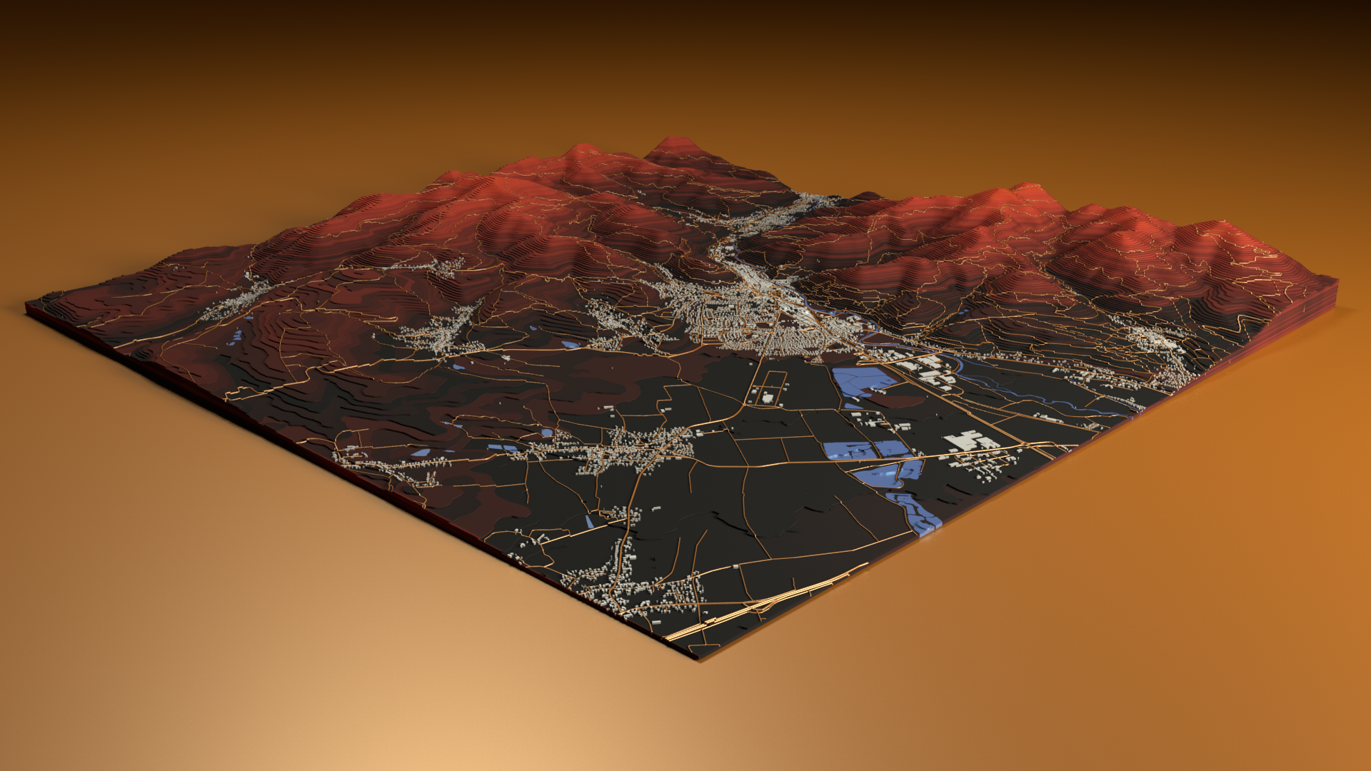
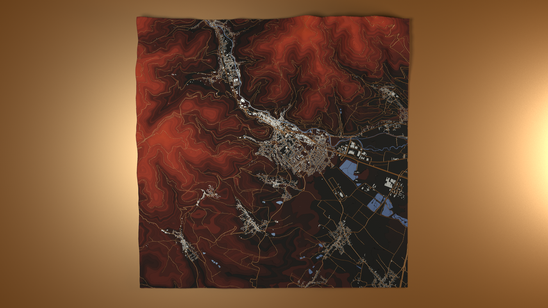
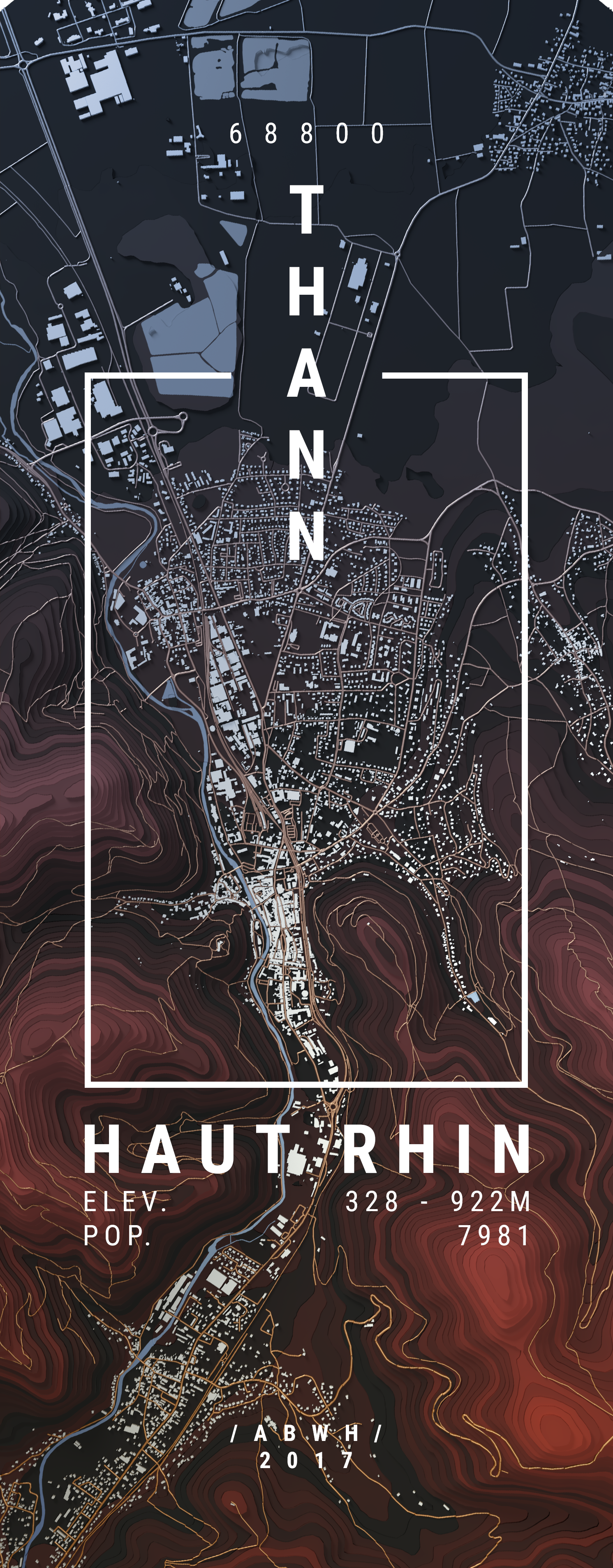
Relief Map
2017
- procedural modelling
- Rendering
- cartography
Created as part of my master’s thesis research Exploratory Three Dimensional Cartographic Visualisation of Geolocated Datasets, this project combines height maps from NASA’s ASTER Global Digital Elevation Model with vector maps from OpenStreetMap. After being processed in a geographic information system, the data was used to procedurally model a digital topographic diorama of Thann - the place I was born.