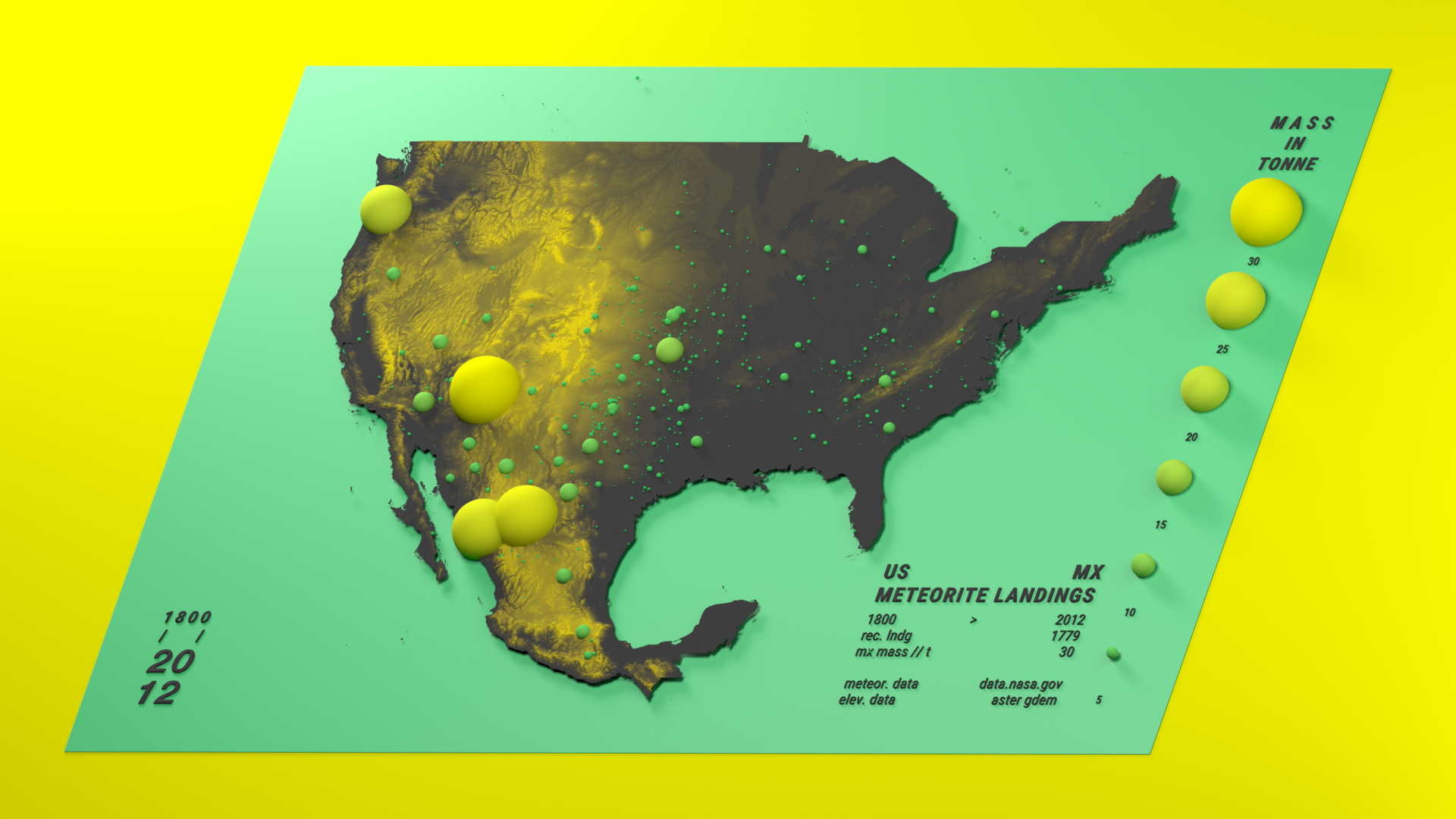
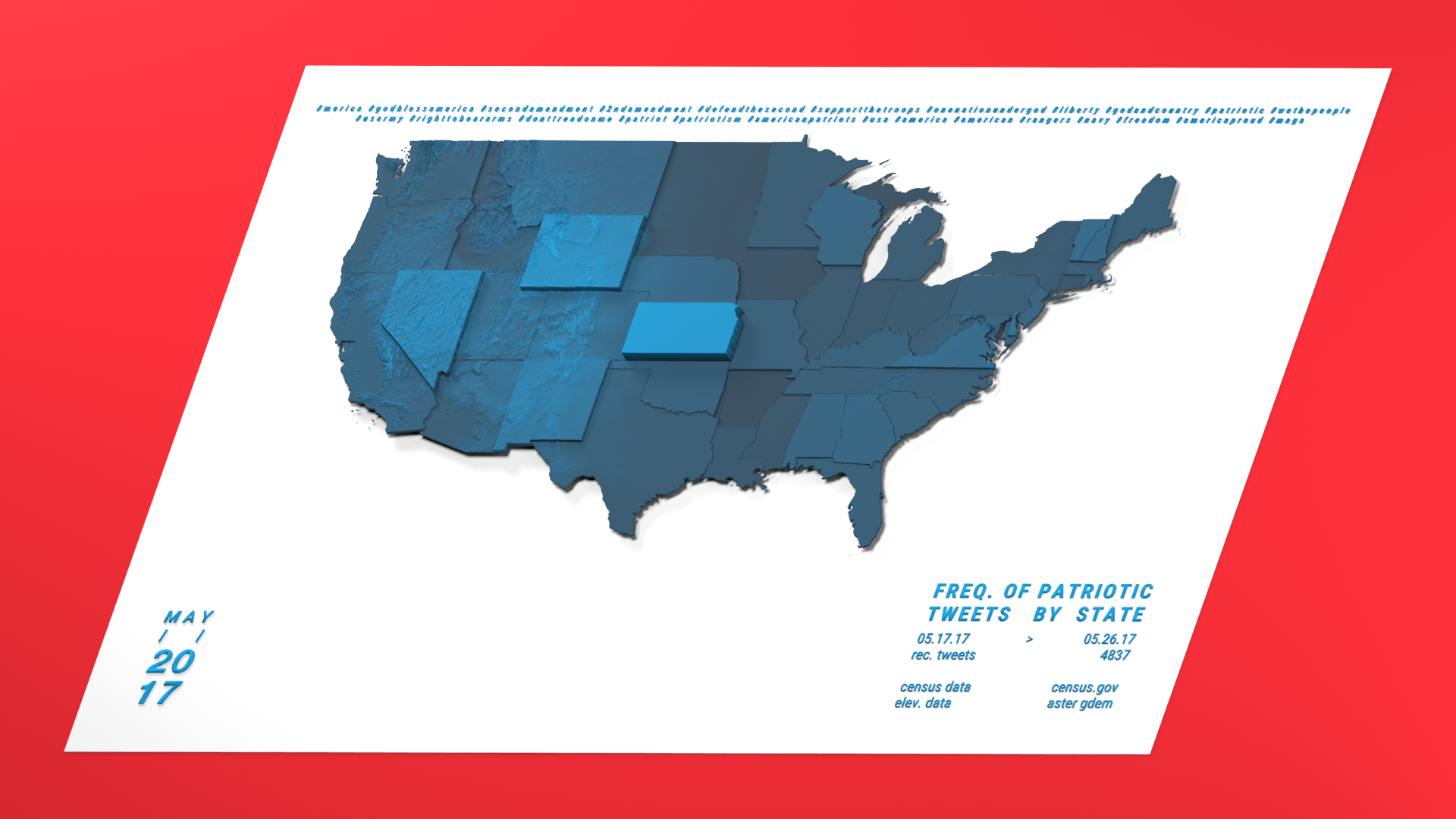
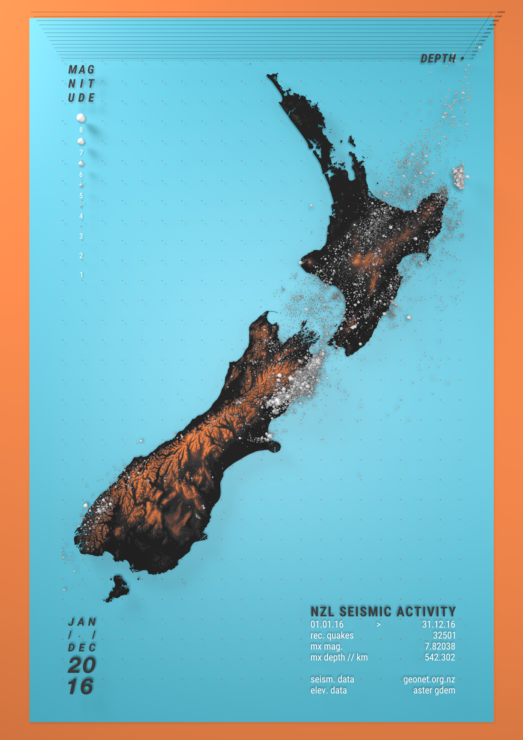
3D Cartography
2017
- data vis
- data mining
- procedural modelling
- Rendering
- cartography
In the process of writing my master’s thesis Exploratory Three Dimensional Cartographic Visualisation of Geolocated Datasets I developed a workflow to process map data and display it in vivid 3D. This experimental research looked to find novel and aesthetically engaging ways to visualise a variety of datasets, such as meteorite falls, geotagged social media data or seismic activity.